Under the Sustainable Groundwater Management Act, the Department of Water Resources (DWR) designated basin boundaries for groundwater in California, stating that there would be an opportunity for the local agencies to propose modifications. A basin boundary modification request was submitted by the MGA to DWR March 16, 2016, and approved on July 1, 2016. The draft-approved boundaries for Bulletin 118 will be posted on-line and included in the Basin Boundary Assessment Tool. The California Water Commission will hear and comment on the draft modification at the July 21st meeting. The boundary modification will be finalized during early September.
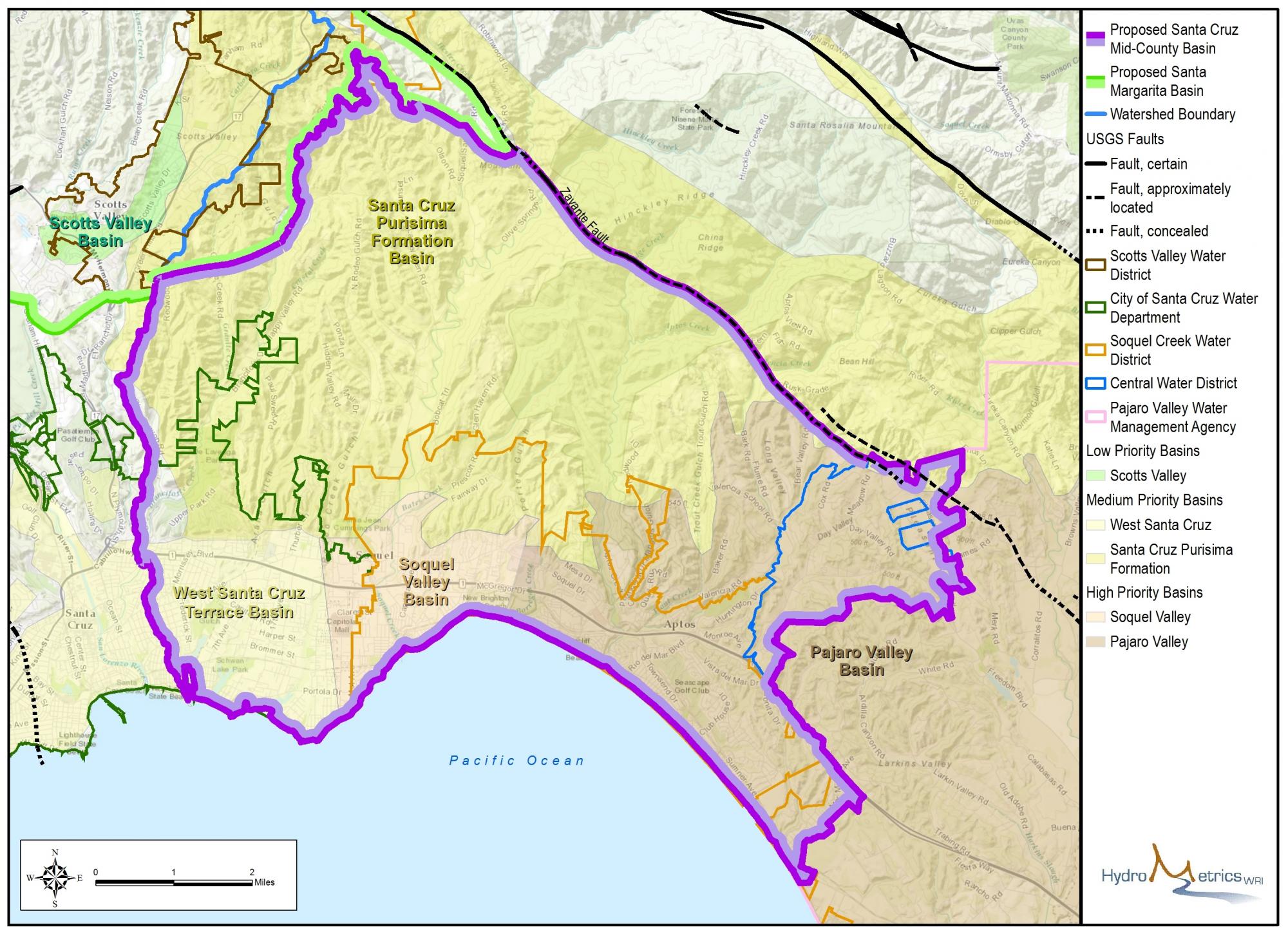
The new basin outline better reflects the groundwater hydrology of our basin, as well as accurately reflecting jurisdictions of agencies managing basins in the region. Below is a map showing the new boundary.
To view the boundaries on an interactive map, you can go to the County's Interactive GIS Portal. Click the white arrow in the upper left corner to open the Layers option. Under Biotic and Water Resources there is a layer called Ground Water Basins, which has both the Santa Margarita and the Mid-County basins. Once those are turned on, you can search different properties to see which basin they fall under.
The Technical Studies (Appendix H) and GIS files (Appendix C) used in the report can be found in the Resource Library
You can click here to find the list of water systems affected by the boundary modification.
Below are links from the Department of Water Resources that describe the basin boundary modification process:
DWR page on Basin Boundary Modifications
DWR Adopted Basin Boundary Emergency Regulation (document that authorizes the new basin boundary modification process)
DWR Basin Boundary Emergency Regulation Fact Sheet (executive summary of the document above)
DWR Groundwater Basin Boundary Assessment Tool (a tool that informs local agencies and the Public about the existing Bulletin 118 groundwater basins and other relevant geologic and geographic data)
DWR Basin Boundary Modification Request System (allows the public to view the list of “Submitted Initial Notifications”)
DWR California’s Groundwater: Bulletin 118 (existing basin maps and descriptions)
DWR Sign-Up for Sustainable Groundwater Management Mailing List