
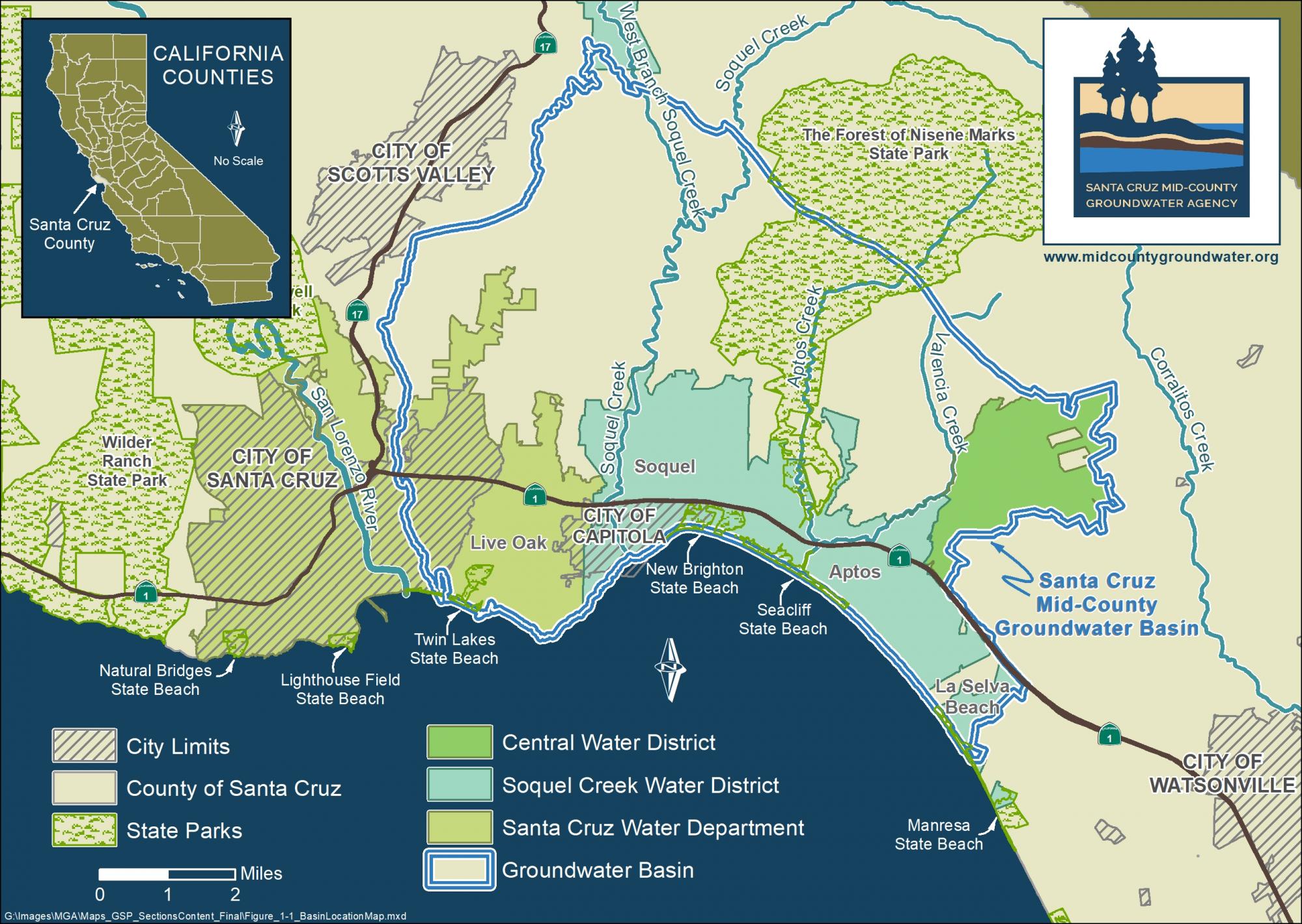
Basin Boundary Area
The Santa Cruz Mid-County Basin extends from the Santa Cruz Mountains (east of Highway 17) from the Zayante fault (somewhat below Summit Road) to the Pacific Ocean and from the edge of the City of Santa Cruz near Twin Lakes in the west to La Selva Beach in the east. The Basin includes portions of the City of Santa Cruz, the City of Capitola, Santa Cruz County census designated places of Twin Lakes, Live Oak, Pleasure Point, Soquel, Seacliff, Aptos, and Rio Del Mar. The Basin also includes portions of Santa Cruz County unincorporated census designated places of Day Valley, Corralitos, Aptos Hills-Larkin Valley, and La Selva Beach. A map of the Basin is visible below.
This links to interactive map that is searchable by address.
Where Does our Water Come From?
Unlike other areas of California that receive imported water from the Sierra Nevada mountains via the stateaqueducts, all of our water is local. No water is imported from outside the region.
Approximately 92,000 people and a diverse natural ecosystem of plants and animals reside within the Santa Cruz Mid-County Basin. About 80,500 residents (88%) receive water from local water agencies and 11,500 receive water from private wells or small water systems. Roughly 50,000 Basin residents (54%) rely entirely upon groundwater for their water supply. Soquel Creek Water District and Central Water District rely upon groundwater. The Basin includes two primary groundwater aquifers: the Purisima and the Aromas Red Sands. An aquifer is a water-bearing geologic formation made up of various layers such as gravel, sand, sandstone, sediments, and fractured rock.
About 42,000 residents within the Basin receive water from the City of Santa Cruz Water Department. In years with average rainfall, the City’s water supply is 95% surface water from sources outside the Basin and 5% groundwater from wells inside the Basin. The County of Santa Cruz does not provide water service but does permit and regulate private groundwater wells and small water systems in the Basin.
.