Storm water infiltration projects are among the potential actions to recharge the groundwater basin. Infiltration projects are typically either basins where storm water is slowed and given an opportunity to spread out and sink down, or dry wells where a top impervious geologic layer is drilled through so that storm water can reach the suitable soils below. Not every location is suitable for storm water recharge. Clay layers, fault lines, granite, and perched aquifers can all prevent storm water from reaching the aquifers we use for water supply. Therefore, before proceeding with project, we need to identify the locations that are most suitable to infiltrate the storm water and have it reach the aquifer. In the past, the only way to understand what the geology beneath the surface looked like was to dig a borehole and analyse the soils by hand. While still the only sure way to know exactly the soils are like at a particular location, there are a number of drawbacks to boreholes. First, a borehole can go very deep, but they are typically only a few inches in diameter, which means many need to be drilled in an area with a heterogenous substrate. Second, they require heavy equipment and can be disruptive and noisey. Third, they are expensive to drill and analyze.
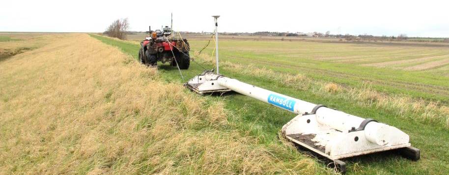
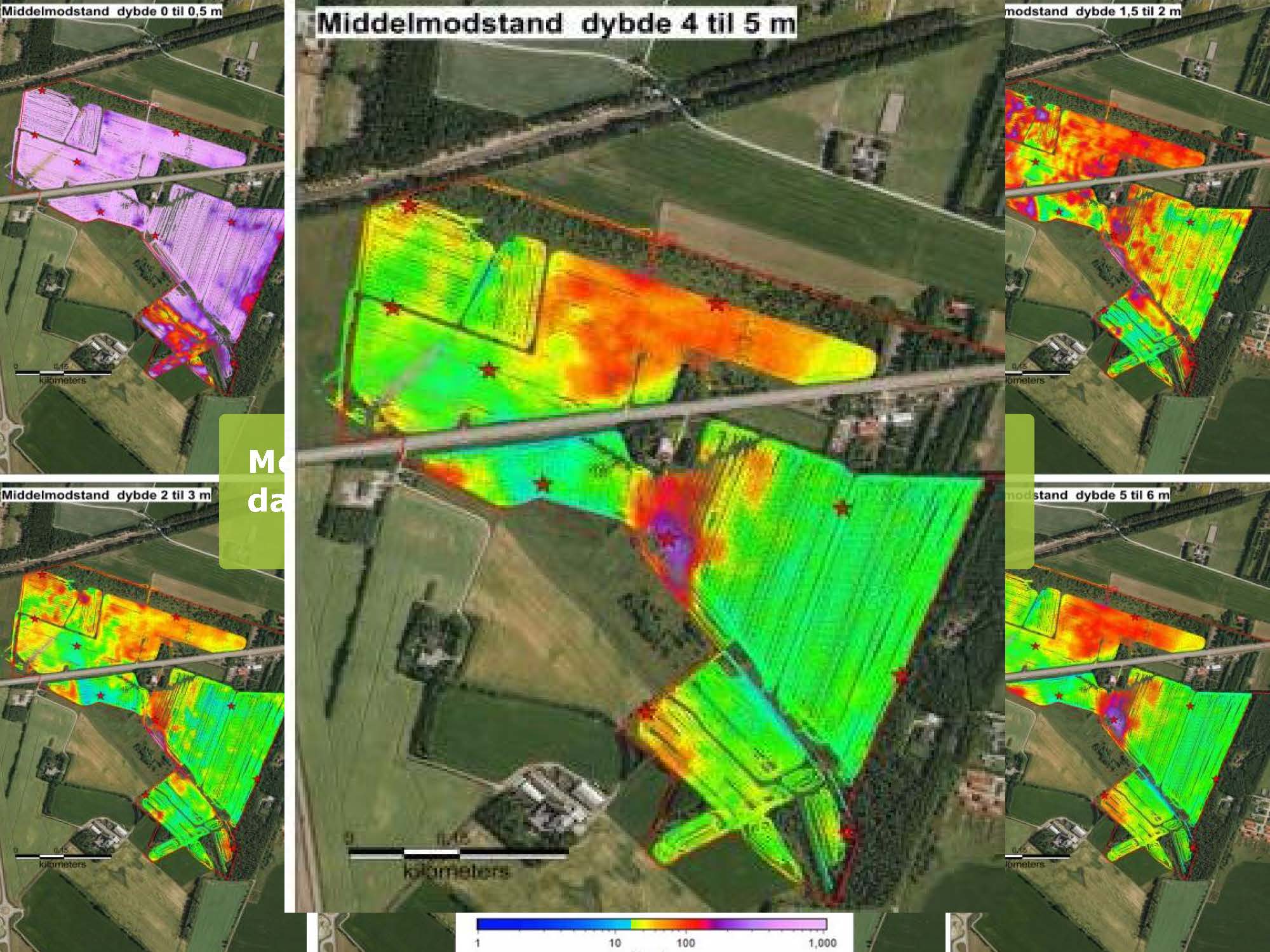
The MGA partnered with the State Water Resources Control Board and Ramboll, to pilot the use of DualEM surveys, using a mapping concept first developed in Denmark and subsequently used around the globe. The DualEM method uses an electromagnetic sensor mounted on a sled, which is towed by an all-terrain vehicle, to map the geology of an area down to a depth of 20 – 30 feet. The sensor can also be carried by hand on challenging terrain. The device measures the electrical resistivity of the soil and by using it to evaluate subsurface conditions, we may be able to prioritize the most promising sites or rule out sites with lower recharge potential without having to conduct more costly testing (i.e. soil borings and percolation tests). Additionally, data collected from the using this method could help inform the best locations for further testing and could theoretically reduce the number of borings required, reducing costs.
Below are some documents about DualEM projects that have been completed:
Infiltration project in Gladsaxe
Infiltration project in Aalborg